algorithmic modeling for Rhino
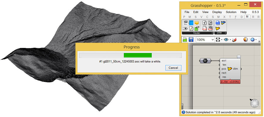
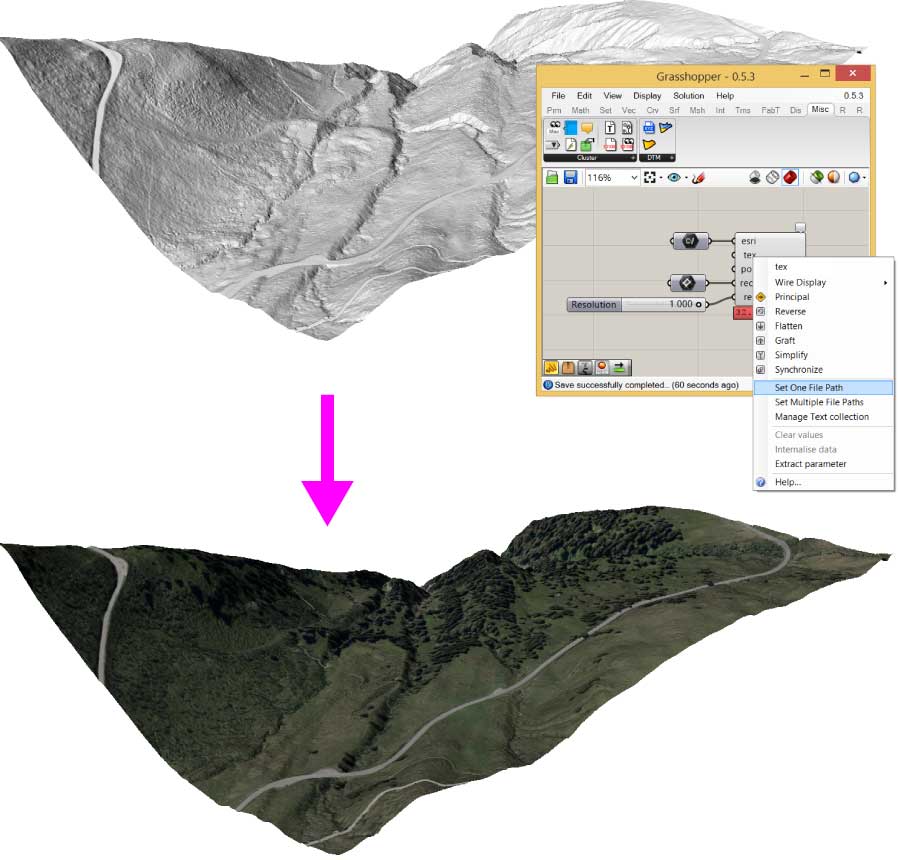
DTM Digitial terrain model mesh
DTM is a set of Clusters, that allows you to build digital terrain models with ascii grid files.
The digital terrain models will be output as meshes and can be textured and baked with the desired satellite image.
download: www.blickfeld7.com/architecture/rhino/grasshopper/DTM/
Views: 5064
Replies to This Discussion
-
Permalink Reply by Aymeric Delmas on
-
-
-
-
Hi guys,
First of all, let me thank you for your great DTM tool. It is simple to use, really functional and with a high quality output mesh., which is awesome.
I am using DTM with data from Opentopography, however the mesh I get as output of the cluster is oversized.
Indeed, the mesh should represent a surface close to 4,500km² (as shown on the Opentopography screenshot attached). But I get a surface close to 41,000km² (as shown on the Grasshopper screenshot attached).
I do not know if this is a bug or if a scaling factor has been applied? Since I would like to use the "actual" scale of the dtm data to merge them with openstreetmap data, I figured that I would contact you.
Best regards, - Attachments:
-
-
 Screenshot 2016-08-02 17.30.59.png, 239 KB
 -
Screenshot 2016-07-21 14.36.21.png, 148 KB
-
-
About
Welcome to
Grasshopper
Translate
Search
Photos
Videos
-
Scaling Tower
Added by Parametric House 0 Comments 0 Likes
-
Field Trap
Added by Parametric House 0 Comments 0 Likes
-

Subd Bridge
Added by Parametric House 0 Comments 0 Likes
© 2024 Created by Scott Davidson.
Powered by
![]()